


Results 1 to 10 of 25
|
|
Hybrid View


-
#1 Guangdong, the nooks and cranniesLife Is Good!

- Join Date
- May 2008
- Location
- Guangdong, China
- Posts
- 1,509
 02-10-2009, 07:42 AM
nooks and crannies - something remote - every part of a place
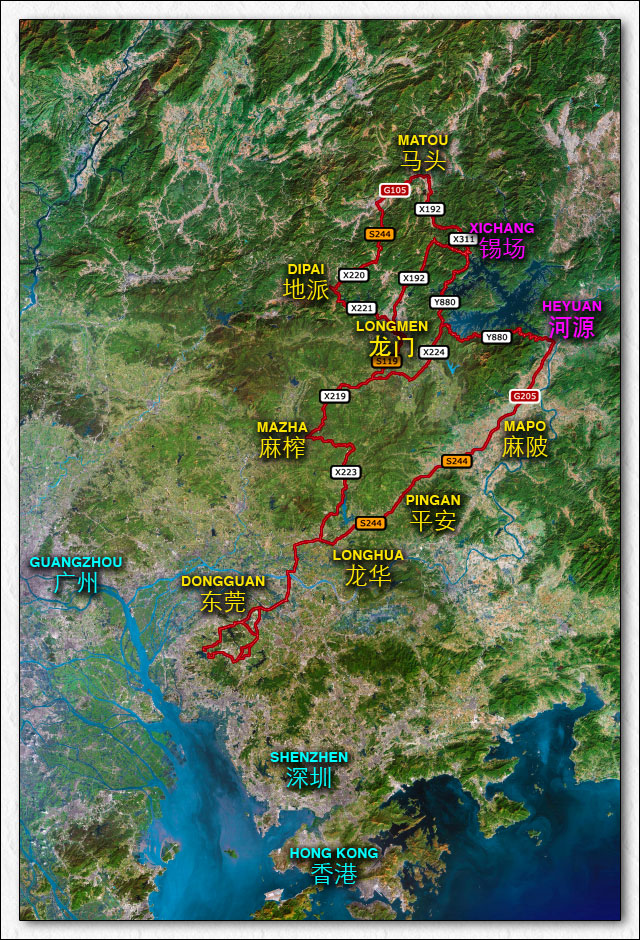
I wouldn't put Guangdong as a destination of choice for epic motorcycle rides in China, but it's home, and over the last six years I've found some special places worth sharing. I'm not really good about posting ride reports, but I promised a few people that 2009 would be better, so here goes.
We all dream of fantastic adventures through restricted provinces, but the reality of life is that most of us living here do our riding on weekends, two or three days at a time. It can be exciting and frustrating. On one hand, you end up covering a lot of the same roads over and over, on the other, you become willing to try anything that looks like a cow trail on google earth.
Chinese new year makes for good riding. Half the population has gone home, container trucks and work crews no longer clog the roads. Weather is mild with temps between 10º-25ºC, no rain for three months, so it's a great time to hit mountain roads that get wiped during the heavy rains of the monsoon season.
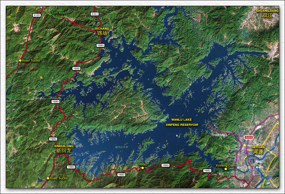
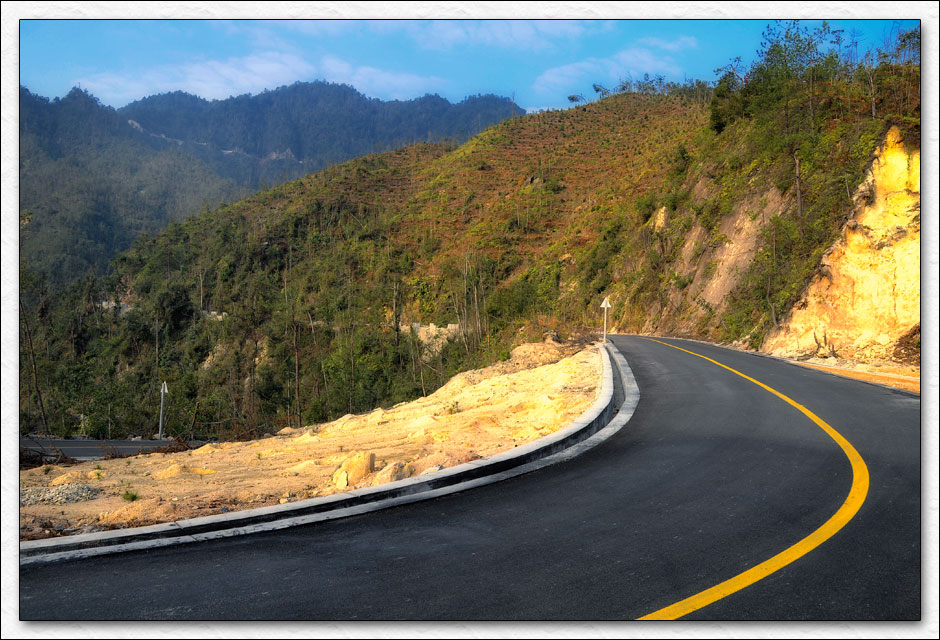
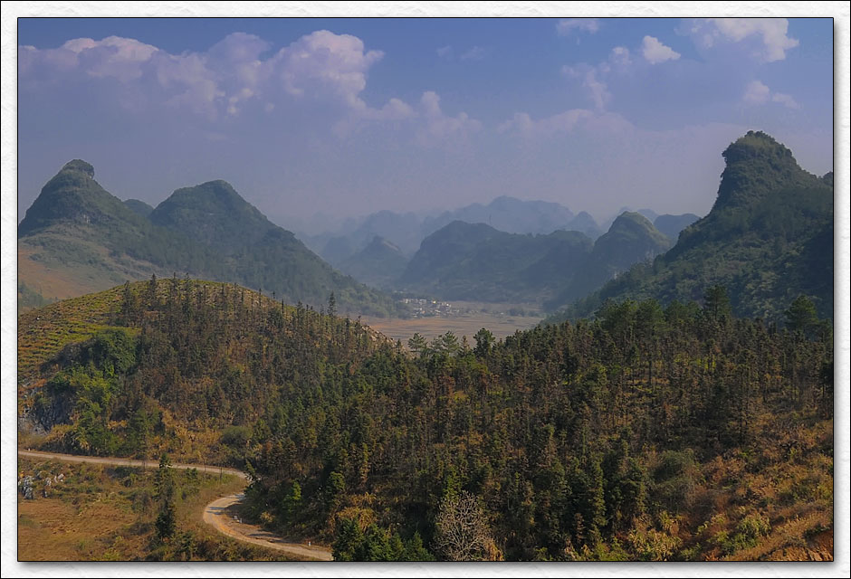
The first area that I wanted to hit was the Xinfeng reservoir (WanLu lake / Evergreen lake / give it another name next year lake), 150 kilometers north-east of home (Dongguan). One of the four largest reservoirs in China, the lake (whatever it's called) holds about 13.9 billion cubic meters of water. An immaculate road borders the south and west sides. I spent four years trying to find it, but like so many other good roads, it was built from the inside out. The south and north entrances are very difficult to access, so nobody goes there . The road is so good, I made two trips just so I could ride it from each direction
  . Here are the two rides.
Starting down south in Dongguan, I headed for Y880 between Xichang and Heyuan each day.
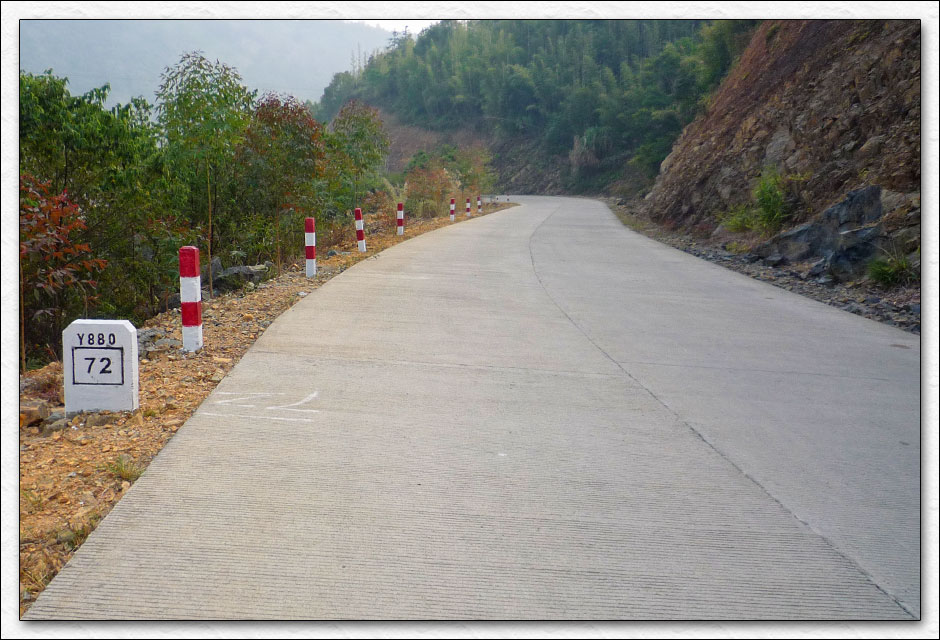
A closer view of the good stuff.
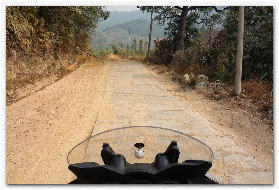
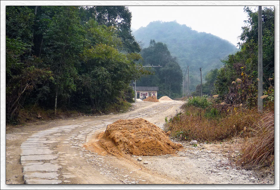
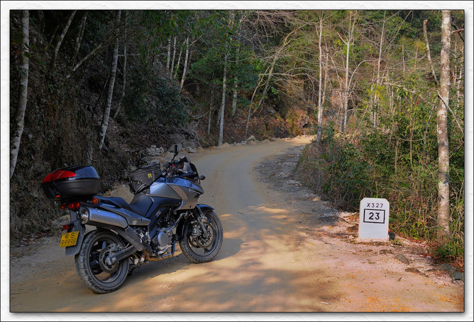
I took the usual route out of town and won't bore you with the details. The first day I headed to Matou so I could enter from the north. I picked a little smudge that looked like a road on google earth and found X220. Not such a great road
Hope they don't catch me on those speed cameras
OK, so much for X220, blast up past Matou and grab X192 and X311. Nice roads with very little traffic as I cross the mountains that feed the reservoir.
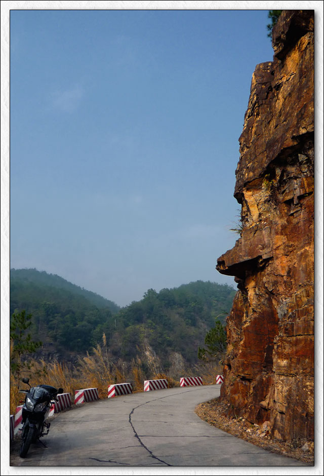
I finally hit Y880 and it's awesome, smooth, clean, new, empty....MINE Stop, take picture...yeah, whatever, I can't believe this goes on for eighty kilometers 
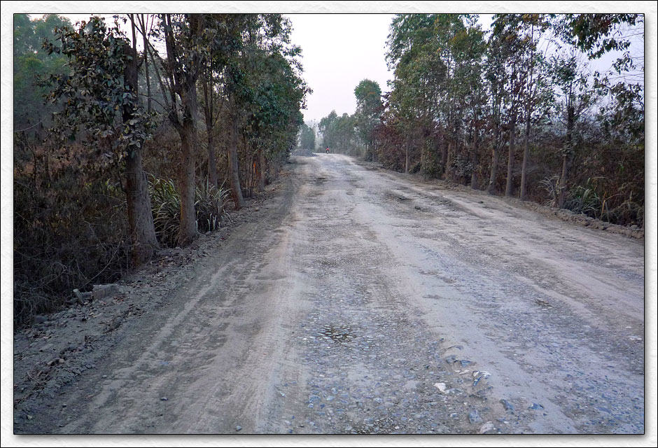
After two hours and a bunch of side excursions, I had only reached the half way point at Xinhuilong. Heading home was the safe bet, the second half of Y880 would have to wait until next time. I continued south on a crappy section of road that led to an even crappier section of road. Behold X224, twenty kilometers of kidney crunching misery, almost one hour wasted.
Back to some familiar roads, but it looks like I'm still going to enjoy a little night riding as I push to get home. Finally arrive at about 8:00 pm, two hours past beer o'clock, what a day. Here's more data than anyone wants know....
Day 1: 22-January-2009
Start Time: 9:32 AM End Time: 7:53 PM
Total Time: 10 Hours 21 Minutes
Moving Time: 9 Hours 46 Minutes
Distance: 526 Kilometers / 327 Miles
Average Speed: 51 kph / 32 mph
Average Moving Speed: 62 kph / 38 mph
Maximum Speed: Really really fast
Maximum Elevation: 469 Meters / 1539 Feet
Fuel Unit Cost (93 octane): 5.42 RMB Per Liter / 3.00 USD Per Gallon
Fuel Total Cost: 150 RMB / 21.96 USD
Fuel Consumption: 19 Kilometers Per Liter / 44.69 Miles Per Gallon
If you want to download a kmz file of day one for Google Earth, please click here.
Thanks for coming along, tomorrow I will post the second half of the Xinfeng reservoir rides.
Cheers!
ChinaV
-
Motorcycle Addict
- Join Date
- Apr 2008
- Location
- near Vienna, Austria
- Posts
- 809
02-10-2009, 01:02 PM
Thanks for the pics and the vid. How do you deal with the soundtrack btw?
Nicely said and very true - we should try to change that once a year for 2 - 3 weeks Originally Posted by ChinaV


As it seems, you have some good stuff down there too
I like the X224 and Y880
Andy
-
Administrator-tron
- Join Date
- Apr 2008
- Location
- NoVA
- Posts
- 2,540
02-10-2009, 03:02 PM
Well written with good photos, video and masterful map work!

All that's missing is food!
CC---------------------------------------------------
Subscribe to the hippest, most happeneing Adventure Motorcycle Magazine around!
Adventure Motorcycle Dual Sport News Magazine
Help support MCM!! Buy "The Return - Riding Western China" DVD! -
http://www.motocyclops.com/buydvd/
Personal China travel info, photo and video site:
http://www.carlparker.com
-
Motorcycle Addict
- Join Date
- Apr 2008
- Location
- near Vienna, Austria
- Posts
- 809
02-10-2009, 03:11 PM
Originally Posted by CrazyCarl
He had only 35 minutes Originally Posted by ChinaV
Andy
-
Senior C-Moto Guru
- Join Date
- Oct 2008
- Location
- Zibo, Shandong - Sometimes SW England
- Posts
- 2,239
02-11-2009, 12:40 AM
Great report!
Nice videos, we have loads of twisty mountain roads like that in this area too (makes you happy you bought a small capacity bike, not much in the way of any choice though) except they don't put tar in the cracks of concrete roads. Looks like it could get a bit slippy in the wet or very hot weather. 
-
Life Is Good!
- Join Date
- May 2008
- Location
- Guangdong, China
- Posts
- 1,509
02-11-2009, 02:04 AM
I was trying to avoid video editing, it takes such a long time to make a good video with music and voice over like Carl and Sabine do. I just open the clip in Quicktime and extract the video track to a new file without audio. I finally started working with Final Cut again, so the upcoming videos in my next installment will be a little better. Originally Posted by chinabiker
I think they call those "tar snakes". Very unpredictable when it gets wet. I think they do it to some of the older roads to keep the water from eroding between the sections of concrete, Sure wish there was more "blacktop", the concrete really chows through tires. Originally Posted by ZMC888
Power Lunch! Originally Posted by CrazyCarl
Cheers!
ChinaV
-
Motorcycle Addict
- Join Date
- Apr 2008
- Location
- near Vienna, Austria
- Posts
- 809
02-17-2009, 01:44 AM
You report proved otherwise Originally Posted by ChinaV
There are good places to ride almost everywhere as it seems. Nice pictures, can't wait to come to GD.
AndyAndy
-
Life Is Good!
- Join Date
- May 2008
- Location
- Guangdong, China
- Posts
- 1,509
02-22-2009, 02:11 AM
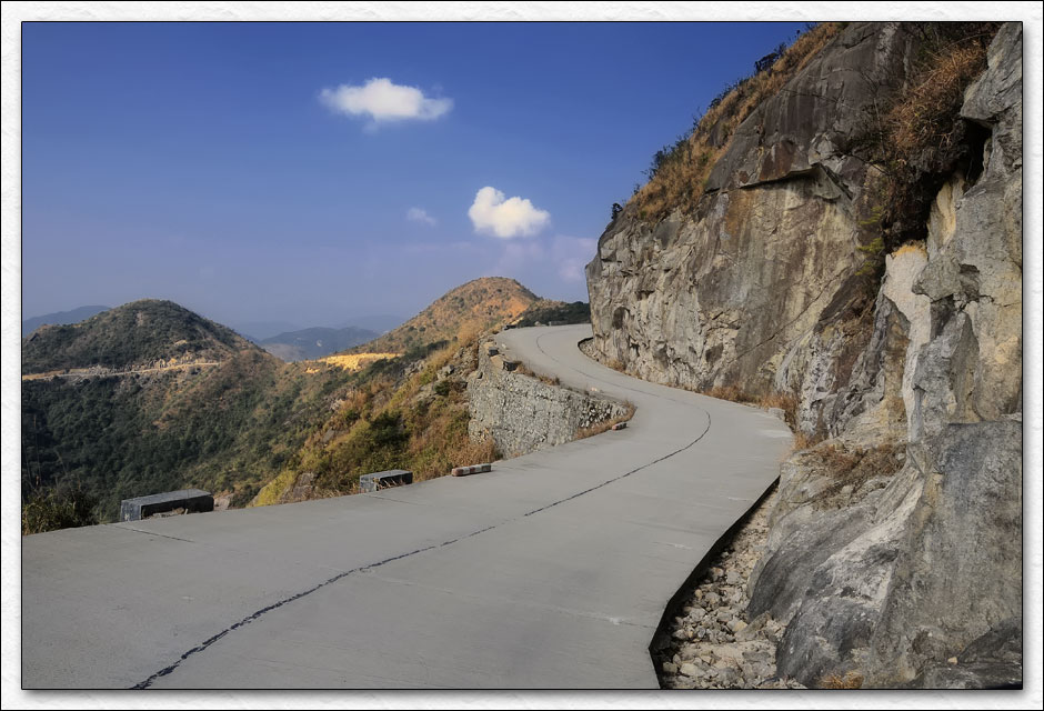
After a good nights sleep I was up early and on the road by seven thirty. The morning was brisk as I headed north out of Ruyuan towards Nanling national park. Heavy morning fog was burning off and it looked like great weather would be in order for the day. I reached the entrance and paid the 60 Yuan (8.75 USD) fee, the attendant looked at the bike and couldn't believe I had come from Dongguan. "Go slow, bad road" he said, I just smiled and nodded. He gave me a couple extra maps, opened the gate and I motored along a few minutes before stopping to worship the fresh black asphalt they had laid down for me.

It's so rare to find mountain roads with this kind of surface here in Guangdong, and I enjoyed all ten kilometers of it.
Then it was back to a mix of packed dirt and gravel.
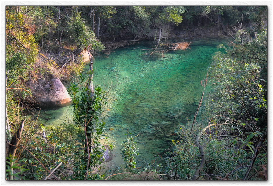
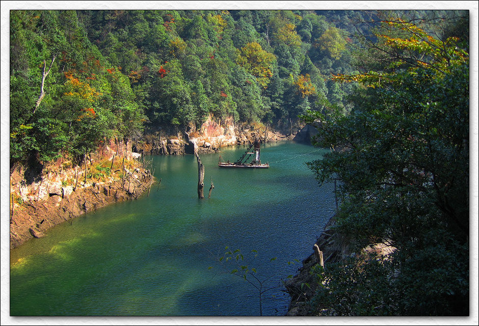
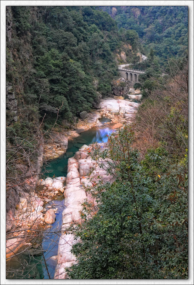
I passed a few small reservoirs with brilliantly clear water.
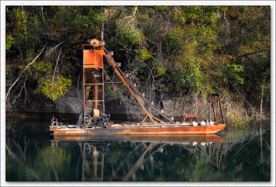
No idea what this contraption does, some kind of mining rig?
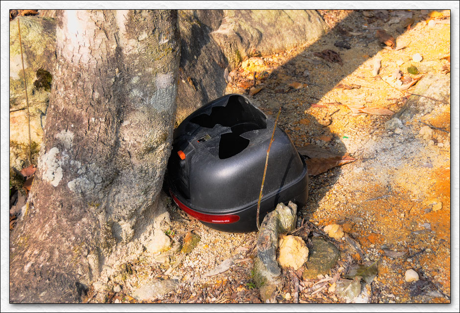
The road became a mix of sharp rocks and deep ruts. I saw this discarded top box which was little encouragement that conditions would improve.
But improve they did, along with the views.
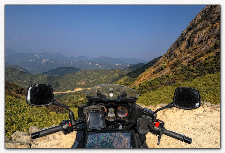
I reached the peak of ShinKenKong at 1902 meters (6240 ft). This is the highest point in Guangdong province and the border of Hunan.
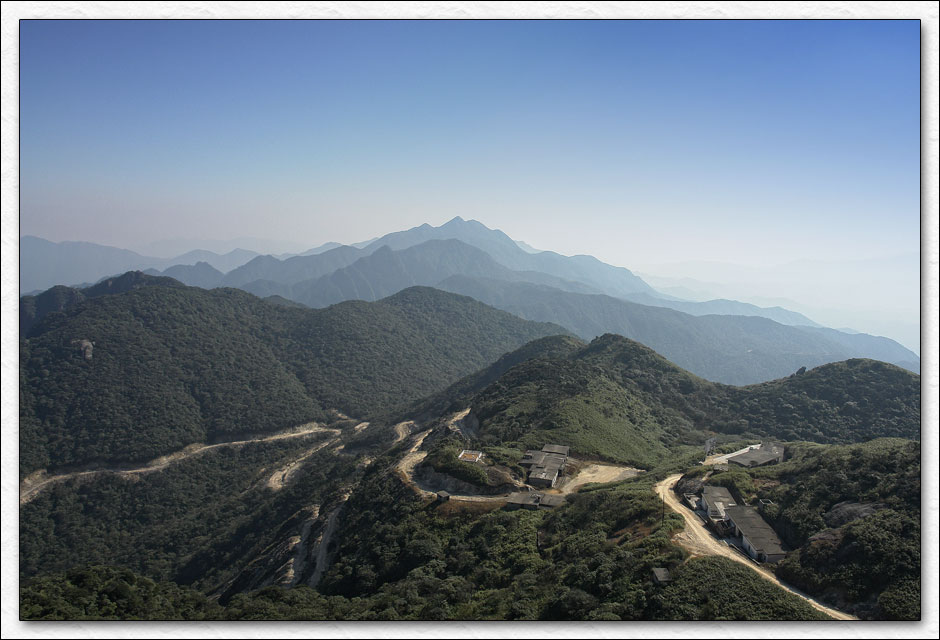
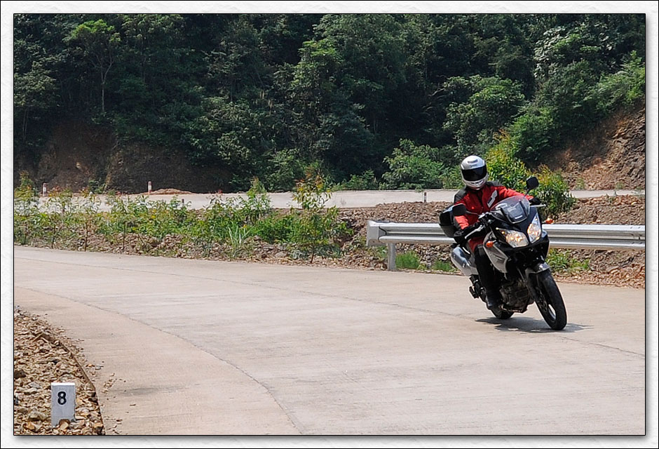
The road south was just completed a few months ago, it's a sweet 75 kilometer ride through the rest of the park.
I followed G323 and S260 through some beautiful valleys until Yangshan.
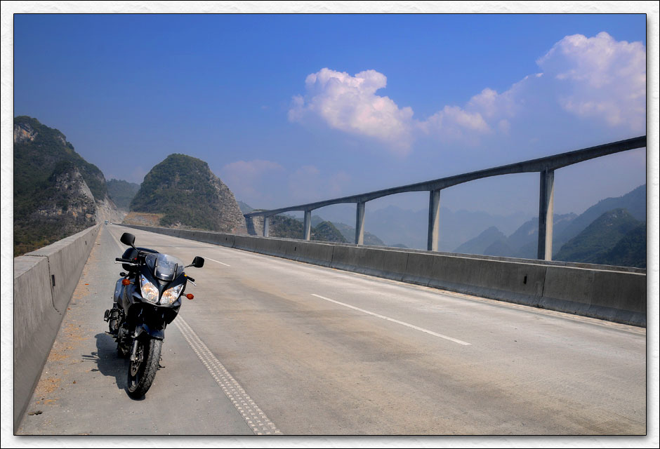
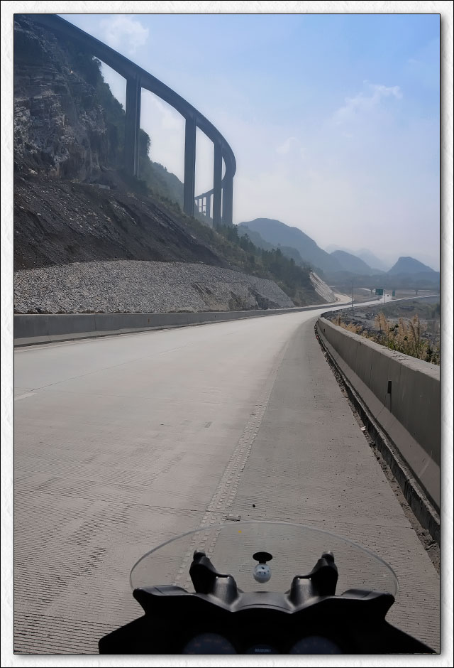
Then I headed for the QingLian Expressway which would take me back home. A couple more shots of the impressive road work.
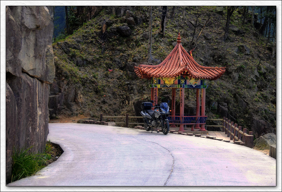
The rest was just retracing my path from the previous day. I'm glad I found this route, it's a great way up to the north-west corner of the province. Made it home 45 minutes before beer o'clock and celibrated with an extra beer, of course.
Thanks for coming along.....
Date: 8-February-2009
Start Time: 7:22 AM ~ End Time: 5:11 PM
Total: 9 Hours 48 Minutes ~ Moving: 7 Hours 14 Minutes ~ Stopped: 2 Hours 34 Minutes
Distance: 455 Kilometers / 283 Miles
Average Speed: 46 kph / 29 mph
Average Moving Speed: 63 kph / 39 mph
Maximum Elevation: 1894 Meters / 6215 Feet.
Cheers!
ChinaV
-
C-Moto Guru
- Join Date
- Apr 2008
- Location
- Xi'an, China
- Posts
- 286
02-22-2009, 05:05 AM
Nice RR
You are the king of the map and the mac.
Could be a good destination for a week end ride with the few other blokes from the area.
Ride report - Few weeks in South West China
-
Motorcycle Addict
- Join Date
- Apr 2008
- Location
- near Vienna, Austria
- Posts
- 809
02-22-2009, 05:20 AM
Thanks for the pics and the report
Impressive bridge construction there. Is it for road or rail ?
It seems you have good weather season in Guangdong.
From what I remember Jan and Feb are best.
Would you accept blokes from other areas too ? Originally Posted by Brice
AndyAndy


| « Previous Thread | Next Thread » |
| Bookmarks |
Bookmarks |


Get vivid impressions and...
Today, 11:58 AM in Off Topic Discussions